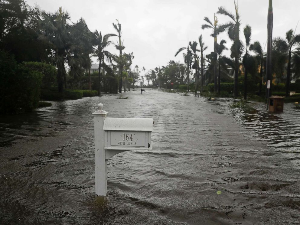
Before crashing into Florida, Hurricane Irma set all sorts of records for brute strength as it flattened Caribbean islands and swamped the Florida Keys. Irma’s assault – so soon after Harvey’s deluge of Houston – marked the first time the U.S. was hit by two Category 4 storms in the same year.
Irma hit the Sunshine State as a big wide beast, though not quite the monster it once was shaping up to be. Earlier, it was the most powerful recorded storm in the open Atlantic. But as the once-Category 5 storm neared the U.S. mainland, it lost some oomph after running into the northern coast of Cuba.
Winds dropped to a quite potent 115 mph (185 kph) by the time Irma made landfall on Marco Island, on the Florida peninsula, still a major and dangerous hurricane yet not near its 185 mph (297 kph) former self when it set a record Tuesday for the most powerful storm in the open Atlantic. And on top of that, Irma avoided what could have been its most destructive paths along the Florida peninsula – over Miami and the heavily developed Atlantic seaboard. Still, at about 400 miles (640 kilometers) wide, it raked much of the state with devastating storm surge, destructive winds and drenching rains before weakening.
“There’s a huge difference between a (Category) 3 and 5 when it makes landfall,” said private meteorologist Ryan Maue of WeatherBell Analytics. “Barbuda is an example of that. It was wiped.”
“This is obviously not the worst case scenario for Florida overall,” Maue said. Had the center of Irma hit Florida 20 to 30 miles (32-50 kilometers) to the east “it would have been much worse.”
Florida can thank Cuba, where it did hit as a Category 5 storm, said Maue and Jeff Masters, meteorology director for Weather Underground.
Irma would probably have hit Florida as a Category 5 hurricane if it had missed Cuba, Masters told The Associated Press.
The storm briefly trekked over Cuba’s low populated coast Friday evening through Saturday afternoon. That weakened Irma enough that when upper level winds from the west eroded some of the storm’s top and also blew in dry air, it had the combined of effect of making Irma more ragged, Masters said. It was at that, he said, that Irma’s southwest eyewall sort of came apart, no longer a perfect circle on satellite imagery.
Slightly weakened from Cuba, the storm got caught up in competing weather systems a little longer, delaying its northward right turn into Florida. And that delay pushed the track further west, making it more of a threat to Florida’s west coast than its east.
Florida’s west coast has about $1 trillion in property at risk to a storm, compared to $1.5 trillion on the east, according to insurance computer modeling firm AIR Worldwide. The company estimates insured losses for Irma will be between $15 billion and $50 billion.
And even another 20 to 30 miles (32-50 kilometers) would have put the nasty and stronger northeast quadrant of stronger winds, storm surge, rainfall and tornadoes more directly in Miami, Maue said. And even hitting the Tampa region from land to the south instead of from open water will reduce storm surge ever so slightly, Masters said.
Despite all that, Masters predicts that when Irma is done it will go down as one of the five costliest hurricanes in U.S. history, but not up with the top three of 2005’s Hurricane Katrina, 2012’s Sandy and this year’s Harvey. Still, he guessed, it will be grouped with two other South Florida storms: 1992’s Andrew and 2005’s Wilma.
Irma’s two U.S. landfalls were unusually powerful. When Irma passed over the Florida Keys Sunday morning its central pressure was the seventh lowest for a smack into the United States. Only the 1935 Labor Day storm, 1969’s Camille, Katrina, Andrew, an 1886 Indianola, Texas, storm, and a 1919 Florida Keys storm were more intense based on atmospheric pressure. Irma ties the killer 1928 Lake Okeechobee hurricane.
Irma’s second landfall on Marco Island, taken by itself, still would rank among the top couple dozen landfalls in intensity, slightly weaker than Harvey.
Irma set plenty of records, according to a two-page list compiled by Colorado State University researcher Phil Klotzbach:
–Its 185 mph (297 kph) winds were the highest on record for the open Atlantic ocean, outside the Gulf of Mexico and Caribbean sea. Only one other storm in the entire Atlantic basin – 1980’s Allen – was stronger.
–It spent three consecutive days as a top-of-the-scale Category 5 hurricane, the longest in the satellite era.
— It generated the second most Accumulated Cyclone Energy – a key measurement that combines strength and duration – in the satellite era. Irma generated about as much as energy as entire normal Atlantic hurricane season.
–It was the strongest storm to hit the Leeward Islands.
–It’s the first Category 5 hurricane to hit Cuba, which regularly gets assaulted by hurricanes, in nearly 100 years.
“This storm is the real deal,” Klotzbach said.


