

As Hurricane Dorian begins to make his exit from Florida’s east coast, the Tampa Bay area is breathing a collective sigh of relief over yet another hurricane miss.
Dorian passed far to the east of the region with nary a gust of wind.
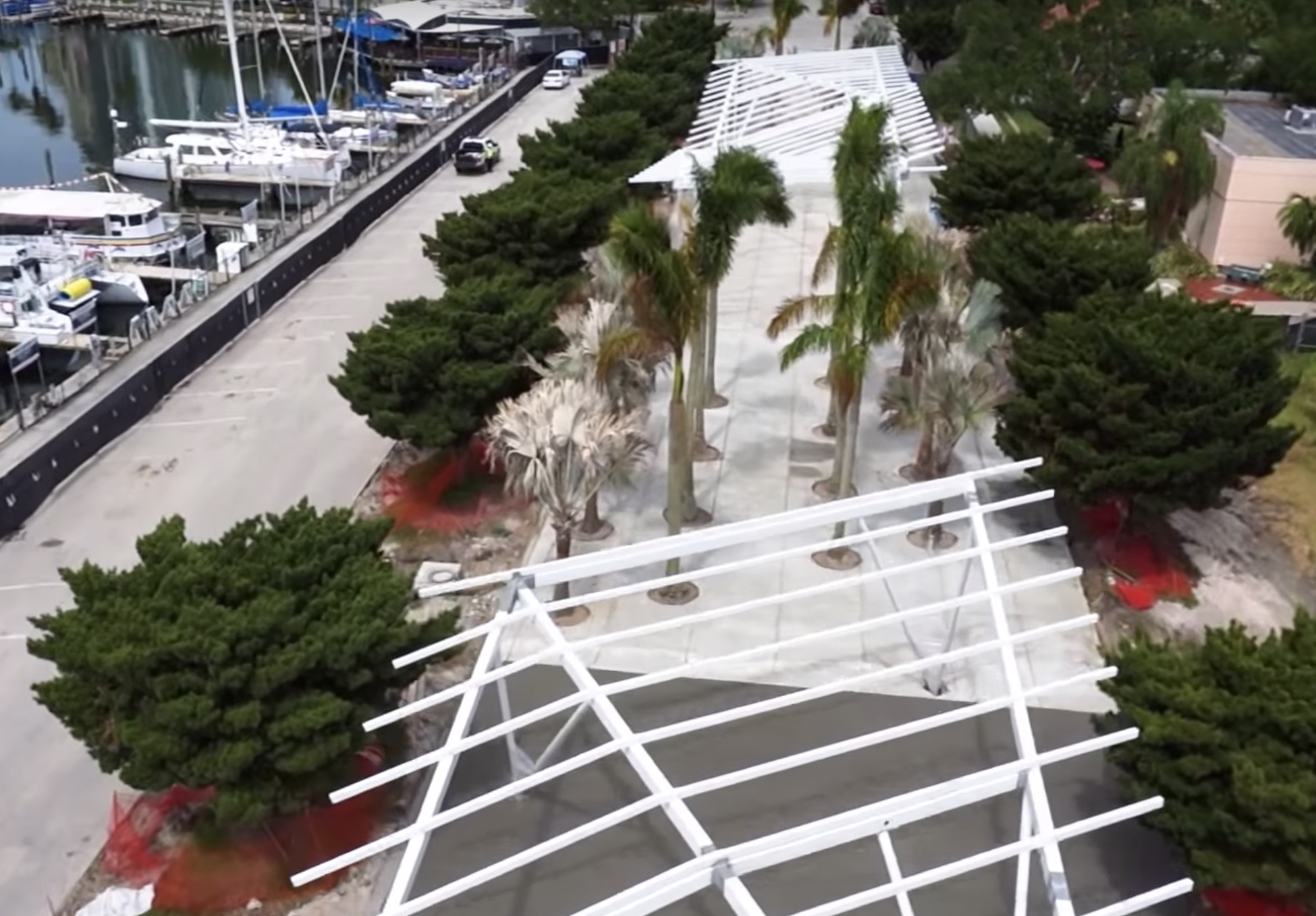
But with construction nearing completion on the new St. Petersburg Pier, what could happen to the city’s more than $80 million investment if the next hurricane that threatens actually hits?
The answer is, hopefully not much.
The city required architects and construction engineers to design the entire project to withstand a 100-year storm event — that is a storm that has a 1 percent chance of hitting a location in any given year. Such events are typically referred to in reference to their ability to produce high levels of precipitation, wind and damage.

To ensure the new pier isn’t reduced to rubble or churned into the bay the first time a major hurricane hits, all buildings on the new pier are designed to withstand winds up to 155 mph, a strong Category 4 hurricane. For context, Hurricane Dorian crashed into the Bahamas over the weekend as a strong Category 5, with sustained winds reaching 185 mph.
So while preemptive building plans would protect the pier from most storms, it might not have fared as well in a Dorian direct-hit scenario.
Much of the damage in the Bahamas though came from flooding and storm surge, which the city planned for, too.
The uplands region of the pier district is designed to be flood resistant with drainage capabilities to minimize flooding impacts. The pier itself is also being built higher than the previous pier. Its frame sits 11.5 feet above sea level, which is 3.5 feet higher than the previous pier.
The elevation was chosen based on sea level rise predictions from the Intergovernmental Panel on Climate Change that estimates 0.6-1.25 feet rise in sea level over the next 50 years and as much as 2.7 feet over the next century.

The pier elevation is higher than Federal Emergency Management Agency requirements and is higher than the anticipated 100-year flood plain.
Still, early estimates put Hurricane Dorian’s storm surge in the Bahamas as high as 23-feet. If that were ever the case in Tampa Bay, the pier would still experience significant flooding.
But the design takes that into mind by installing a resilient structure and landscape. Recovering from a Dorian-like event at the new pier would take work, the city said, but the pier’s design is created so that recovery is possible.
For example, the design includes pavers and concrete that can survive being submerged and significant wave action.
This is all hypothetical. The last time a major hurricane hit the Tampa Bay region directly was in 1921 when the aptly named Tampa Bay Hurricane made landfall near Tarpon Springs in north Pinellas.
But while the region has gone relatively unscathed for nearly a century, major hurricane predictions show bad news for the region, particularly if a storm swept into the mouth of Tampa Bay.
In 2014 the Tampa Bay Regional Planning Council released a video depicting a fictitious “Hurricane Phoenix” making landfall in mid-Pinellas County that forecasters hypothesized would create a storm surge of more than 20-feet, winds that would level half the region’s structures and flooding that could claim the lives of more than 2,000 people, more than Hurricane Katrina.
The Washington Post published an expose in 2017 on Tampa Bay’s vulnerability to an eventual direct hit noting the region was among the top-ten most vulnerable places in the world.
Those were all pieces of analysis the city took into consideration when planning its new pier.
But the bottom line is, even with sound planning, structures like the St. Pete Pier will always be at risk.
The 2019 Hurricane Season is entering its most dangerous period for the Tampa Bay area as conditions in the Gulf of Mexico make it rife for producing strong hurricanes that could be pushed into Florida’s west coast. September and October are the busiest months for landfall in Florida, according to the Weather Channel.
One comment
gary
September 5, 2019 at 1:19 pm
The chance of St.Pete seeing a cat 5 is virtually impossible, as it would have to come from the gulf as a 5 and cross St.Pete to get to the pier as a 5! Can’t happen.
Comments are closed.