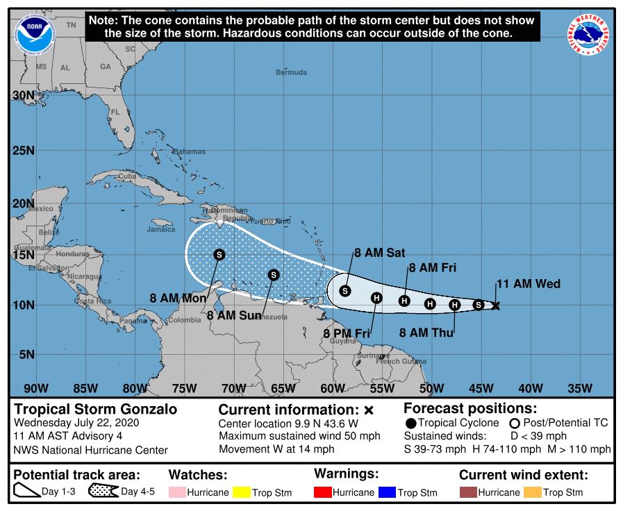
A tropical storm formed in the Atlantic Ocean Wednesday, according to the National Hurricane Center.
As of the latest update, Tropical Storm Gonzalo is roughly 1,250 miles east of the southern Windward Islands and has maximum sustained winds of 45 mph.
The storm is traveling in a west-northwest direction at 12 mph.
“While it is too soon to determine the magnitude and timing of those impacts, interests in the southern Windward Islands should monitor the progress of Gonzalo,” the NHC said.
#Gonzalo has formed in the tropical Atlantic this morning. Looking pretty impressive lately as well- definitely one to watch for the Windward Islands. 👀 🌀 pic.twitter.com/RW918MuHvs
— Eric Blake 🌀 (@EricBlake12) July 22, 2020
Gonzalo is the earliest seventh named storm on record in the Atlantic basin, beating Tropical Storm Gert in July 2005 by two days, according to the NHC.
This year, Christobal, Danielle, Edouard and Fay are also recorded as the earliest named storms based upon their place in the alphabet.
Projections have yet to determine whether Gonzola will impact the U.S. mainland but suggest a possible landfall over the Caribbean. Wind shear north of the system could affect the storm. It’s a small system, which could be good or bad depending on conditions. Smaller storms can rapidly increase in strength and size, but they are also more susceptible to breaking up.
Meanwhile, a tropical wave producing disorganized showers and thunderstorms is traveling north through the Gulf of Mexico.
The NHC estimates the tropical wave has a 40% of developing into a tropical depression as it travels toward Texas.
Hurricane Hunters are scheduled to investigate that wave Wednesday if necessary.


