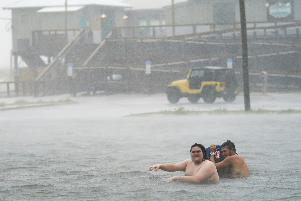
A newly strengthened Hurricane Sally pummeled the Florida Panhandle and south Alabama with sideways rain, beach-covering storm surges, strong winds and power outages early Wednesday, moving toward shore at an agonizingly slow pace that promised a drawn out drenching and possible record floods.
Some 150,000 homes and businesses had lost electricity by early Wednesday, according to the poweroutage.us site. A curfew was called in the coastal Alabama city of Gulf Shores due to life-threatening conditions. In the Panhandle’s Escambia County, Chief Sheriff’s Deputy Chip Simmons vowed to keep deputies out with residents as long as physically possible. The county includes Pensacola, one of the largest cities on the Gulf Coast.
“The sheriff’s office will be there until we can no longer safely be out there, and then and only then will we pull our deputies in,” Simmons said at a storm briefing late Tuesday.
This for a storm that, during the weekend, appeared to be headed for New Orleans. “Obviously this shows what we’ve known for a long time with storms – they are unpredictable,” Pensacola Mayor Grover Robinson IV said.
Hurricane Sally’s northern eyewall is raking the Gulf Coast with hurricane-force winds and rain from Pensacola Beach westward to Dauphin Island, Alabama, the National Hurricane Center said.
Forecasters say landfall won’t come until later Wednesday when the center of the very slow moving hurricane finally reaches the coast. Sally remains centered about 50 miles south-southeast of Mobile, Alabama and 40 miles southwest of Pensacola, with top winds of 105 mph, moving north-northeast at 3 mph.
Stacy Stewart, a senior specialist with the National Hurricane Center says the Category 2 hurricane could strengthen further before the entire eyewall moves inland.
The hurricane will bring “catastrophic and life threatening” rainfall over portions of the Gulf Coast, Florida panhandle and southeastern Alabama through Wednesday night, he said. Stewart said the hazards associated with the hurricane are going to continue after it makes landfall, with the storm producing heavy rainfall Wednesday night and Thursday over portions of central and southern Georgia.
Sally was a rare storm that could make history, said Ed Rappaport, deputy director of the National Hurricane Center.
“Sally has a characteristic that isn’t often seen and that’s a slow forward speed and that’s going to exacerbate the flooding,” Rappaport told The Associated Press.
He likened the storm’s slow progression to that of Hurricane Harvey, which swamped Houston in 2017. Up to 30 inches (76 centimeters) of rain could fall in some spots, and “that would be record-setting in some locations,” Rappaport said in an interview Tuesday night.
Although the hurricane had the Alabama and Florida coasts in its sights Wednesday, its effects were felt all along the northern Gulf Coast. Low lying properties in southeast Louisiana were swamped by the surge. Water covered Mississippi beaches and parts of the highway that runs parallel to them. Two large casino boats broke loose from a dock where they were undergoing construction work in Alabama.
___
Republished with permission of the Associated Press.


