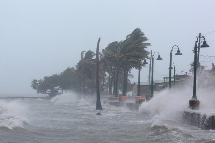
The morning of Sept. 11, 2017 saw the Jacksonville area waking up to the devastation left by Hurricane Irma, even without a direct hit as suffered out west.
Onshore flow rocked Jacksonville’s beaches in the wake of Matthew. Flood waters coursed through St. Augustine, yet again, along with low-lying areas, such as Downtown, Riverside, Old Mandarin, Broward Road, and San Marco. Impacts in many places exceeded that of 1964’s Hurricane Dora: the previous benchmark for the area; downtown saw flooding unseen since the 19th century. Docks throughout town: destroyed.
Tree damage was noticed even before Irma made its approach, a fierce Nor’easter serving as the hurricane’s warm up act; winds that gusted past Category 1 throughout the night only exacerbated that.
Meanwhile, the city itself was not spared. A symphony of exploding power transformers started before midnight and continued even as day broke, with well over 270,000 JEA customers without power at 9:40 a.m. — more than was the case in the wake of Matthew, even as the storm’s tropical storm force winds gusted to gales as the system made its exit.
The Beaches, evacuated days before, are in the dark.
Jacksonville, still waiting for federal reimbursements totaling $26 million from Matthew, was in no position to assess the financial hit taken early Monday morning. The city, Mayor Lenny Curry said before the storm, had “adequate reserves” to take a Matthew-sized hit. But, as the storm bore down on Jacksonville for over 12 hours with tropical storm winds and higher gusts, there were strong indications that hit may be harder than the one incurred last year.
Right now, Curry said it’s “too early” to assess financial impacts; right now, it’s about saving lives.
However, there was plenty that could be said. And as elsewhere in Florida, there is plenty to rebuild. But for some, the worst is not over.
“Serious storm surge,” Curry said, was along the river, bringing “serious flood risk.”
Those who need rescue from flood-prone areas are encouraged to put a white flag outside, to show they are in distress.
City and state rescue teams will be available. JFRD has already gotten one call per minute.
“3 teams -22 LEOs- of pre-staged FWC officers are en route to Jacksonville areas where flooding is reported,” asserted Gov. Rick Scott‘s deputy communications director, McKinley Lewis, after the briefing.
Flooding, said the NWS weather person, has already surpassed historic levels, and will only get worse with this afternoon’s high tide.
“The data that we had spoke to the seriousness of this storm,” Curry said regarding the evacuation.
There’s no data as to fatalities, but injuries via trees through houses and structure fires are another matter.


