

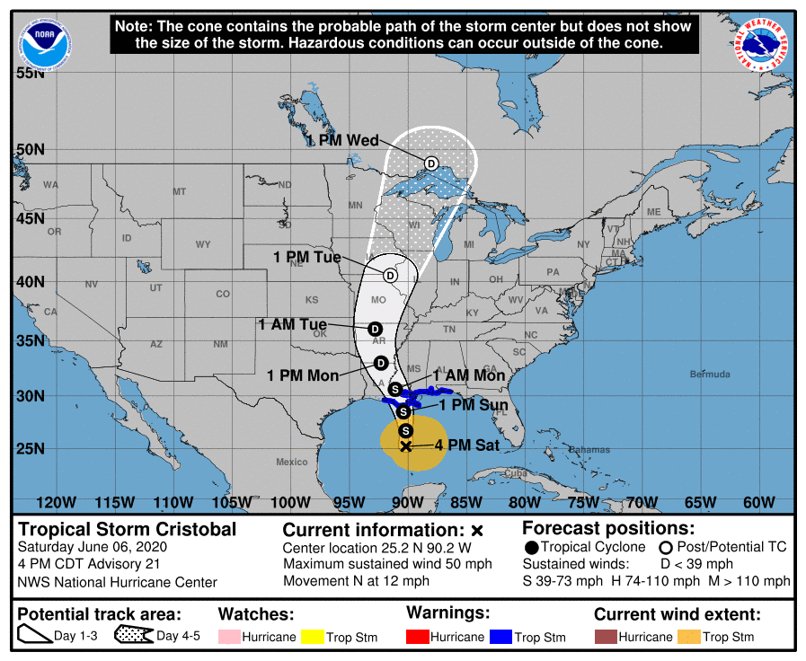
Tropical Storm Cristobal is expected to deliver heavy rain and tropical storm force winds late Saturday along portions of the northern Gulf Coast as the weather system crawls north through the Gulf of Mexico.
As of Saturday evening, the National Weather Service reported the storm to be roughly 520 miles southwest of Panama City and traveling at a speed of 12 mph.
The storm, which is forecast to directly strike Louisiana, is expected to produce heavy rains and deliver maximum sustained winds of 50 mph that extend 240 miles outward from the storm’s center. The storm is also forecast to deliver three to six inches of rain.
Landfall for the Florida Big Bend, Mississippi and Louisiana is forecasted for late Saturday night or early Sunday morning.
“These winds will arrive well in advance of and extend well east of Cristobal’s center,” the National Weather Service advised.

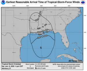
Tropical storm and storm surge warnings remain in effect for portions of Florida’s Big Bend and the western panhandle.
A tropical storm warning means that tropical storm conditions can be expected in the area within 36 hours.
The National Weather Service reported storm surge flooding to pose the greatest threat with potential for two to four feet of flooding at certain points near the panhandle coast.
The National Weather Service also warned of isolated flash flooding and the potential for a tornado or two along the Panhandle coast.
“Residents in these locations should follow advice given by local emergency officials,” the National Weather Service said.

Current models forecast the tropical storm to gradually strengthen through Sunday before slightly turning northwest toward later that day.
Monday marked the start of a 2020 hurricane season which is expected to bring “above-normal” activity, according to the National Oceanic and Atmospheric Administration.
NOAA forecasted a range of 13 to 19 named storms, six to 10 of which could become hurricanes. The NOAA also estimated that three to six of the storms could be major hurricanes producing winds of 111 mph or higher.