

Heavy rainfall will continue across the panhandle Sunday as Tropical Storm Cristobal continues north toward the Central Gulf Coast of Mexico.
As of Sunday morning, Cristobal was forecast to produce four to eight inches of total rainfall in the Central Gulf region. Two to four inches, however, are expected in the eastern Gulf Coast.
The latest advisories from the National Hurricane Center show the storm traveling at a speed of 12 mph. Cristobal is expected to take a gradual northwest turn later in the day.
Data from an Air Force Reserve reconnaissance aircraft reported the maximum sustained winds remaining near 50 mph with higher gusts.
The National Hurricane Center also reported the tropical-storm-force winds extending outward up to 205 miles from the storm’s center, particularly toward the eaast of the storm’s center.

Little change in forecast is expected prior to landfall.
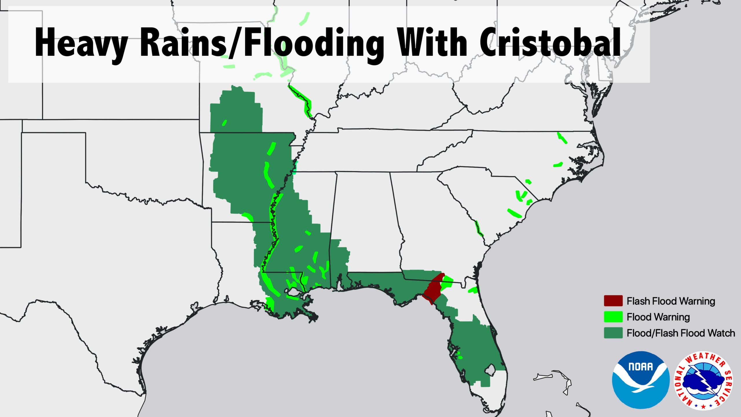
The brunt of Cristobal’s impact will be concentrated near Louisiana and Mississippi.
“Central Gulf Coast region will be most prone to issues after the passage of the center of Cristobal Sun night — Mon,” the National Weather Service advised.
Portions of the Florida panhandle, however, remain under Tropical Storm and Storm Surge warnings.
A storm surge warning means there is a life-threatening danger of water rising from the coast and moving inland within the next 36 hours.

The storm surge warning extends east from southeastern Louisiana to the Florida panhandle.
Here is an experimental graphic that depicts the forecast storm surge inundation values from the #Cristobal public advisory. These values represent the peak height the water could reach above normally dry ground somewhere within the specified areas. More https://t.co/tW4KeFW0gB pic.twitter.com/5yoTvDl98M
— National Hurricane Center (@NHC_Atlantic) June 7, 2020
The National Hurricane Center projected possible storm surges of one to three feet in areas including Marco Island, Florida through the Big Bend and south toward Tampa Bay.
Tornadoes are also possible throughout Sunday in northern Florida.
On Saturday, a tornado touched down near downtown Orlando. Damage assessments after the tornado are ongoing. No injuries were reported.
Our crews continue to assess the damage from last night’s severe weather. Grateful there were no injuries. pic.twitter.com/JG6biYLqOY
— Orlando Fire Dept (@OrlandoFireDept) June 7, 2020
The tornado was spotted near Lake Conway and the College Park area.
BREAKING: Possible tornado spotted southwest of downtown Orlando, near College Park. pic.twitter.com/A4DFAJpkl4
— Joe Kelley (@talkradiojoe) June 6, 2020
The National Hurricane Center also warned the threat of flash flooding in the panhandle will loom over the course of 72 hours. The NHS described flash flooding as a “significant hazard.”