

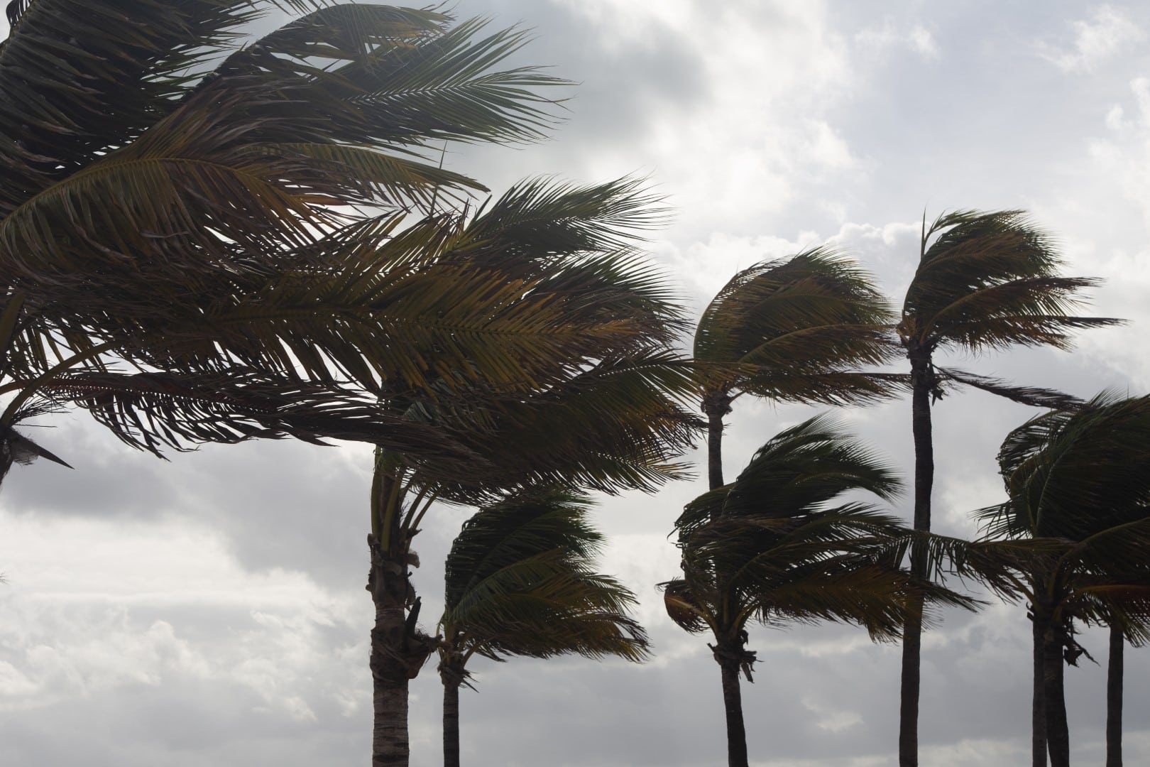
While Potential Tropical Cyclone Nine failed to strengthen into Tropical Storm Isaias overnight, Florida still remains in the system’s projected path, which is expected to make landfall over the weekend.
According to the National Hurricane Center’s 11 a.m. update, the system is roughly 240 miles away from San Juan, Puerto Rico and traveling in a west-northwest direction at 23 m.p.h. The system is producing maximum sustained winds of 45 m.p.h. with tropical-storm-force-winds extending outward up to 275 miles from the center.
Forecasters said the system has 90% chance of developing into a tropical storm within the next 48 hours.
Tropical storm warnings remain in effect in much of the Caribbean including Puerto Rico, the Leeward Islands and the Virgin Islands. A full list of tropical storm warnings can be found online.
“Potential Tropical Cyclone Nine will produce heavy rains and potentially life-threatening flash flooding and mudslides across the northern Leeward Islands, the Virgin Islands, Puerto Rico, and the Dominican Republic,” the NHC advised.

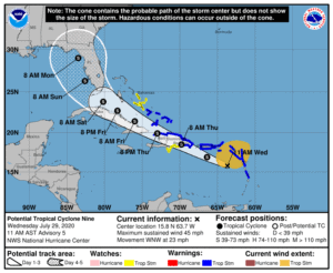
While Florida remains in the projected path, the NHC is warning that the long-range track of the system and its intensity remain uncertain due to the storm’s lack of a well-defined center.
Chief Financial Officer Jimmy Patronis is urging Floridians to ready their supplies and monitor weather alerts.
“Floridians know all too well the devastation hurricanes can have on their lives and we must take this threat seriously,” Patronis said. “As we saw with Hurricane Michael, hurricanes can form and strengthen quickly, leaving little time to prepare and evacuate. The time is now to prepare and protect your home and business. Heed all watches and warnings from state and local officials and do not wait until a storm is making landfall. Prepare now, Florida!”
If developed, Isaias will become the earliest storm to be listed with an “I” on record, underscoring the 2020 hurricane season’s above-normal activity.
2 comments
St. A. Pete
July 30, 2020 at 5:18 am
What’s up with the sharpie marks? Did the President get ahold of that map?
Sonja Fitch
July 30, 2020 at 3:21 pm
St you funny
Comments are closed.