

Hurricane Lee whirled through open waters toward the northeast Caribbean late Thursday becoming the first Category 5 storm of the Atlantic season.
Lee was not expected to make landfall although forecasters said tropical storm conditions are possible on some islands. Meteorologists said it was too early to provide details on potential rainfall and wind gusts.
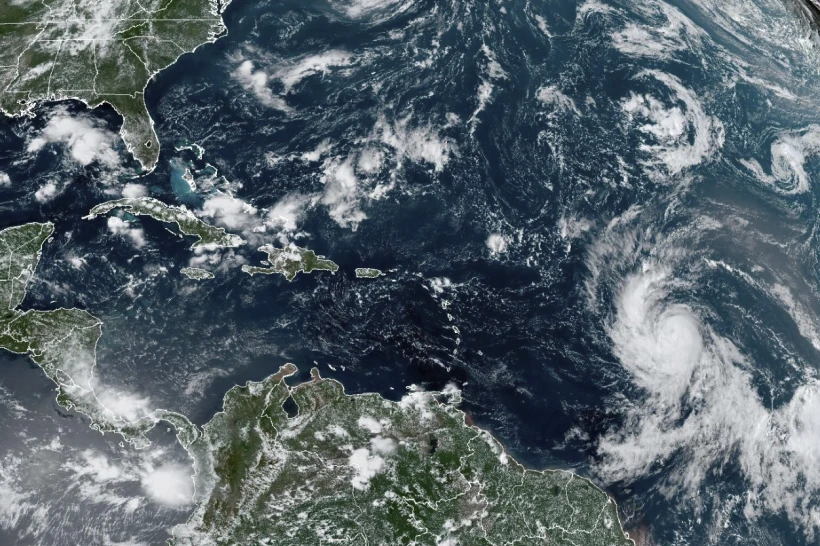
The Category 5 hurricane was located about 705 miles east of the northern Leeward Islands. It had winds of up to 160 miles per hour and was moving west-northwest at 14 mph.
The storm was expected to remain a major hurricane into next week.
“Lee continues to strengthen at an exceptional rate,” the National Hurricane Center said.

President Joe Biden on Thursday was given the hurricane’s latest trajectory and details of preparations underway by the Federal Emergency Management Agency, which deployed unidentified assets to Puerto Rico and the U.S. Virgin Islands, according to the White House.
Life-threatening surf was expected to hit the Lesser Antilles on Friday and reach the British and U.S. Virgin Islands, Puerto Rico, Hispaniola, the Bahamas and Bermuda this weekend, the center said.
“We will see waves between 10 and 15 feet, so we don’t want anyone on the beaches,” said Ernesto Morales with the National Weather Service in San Juan, Puerto Rico.
The National Hurricane Center said dangerous surf and rip currents were forecast for most of the U.S. East Coast starting Sunday.
Lee is the 12th named storm of the Atlantic hurricane season, which runs from June 1 to Nov. 30 and peaks in September.

Tropical Storm Margot became the 13th named storm after forming on Thursday evening. It was located some 290 miles west-northwest of the Cabo Verde Islands. It had winds of up to 40 mph and was forecast to strengthen into a hurricane over the weekend. It was moving west-northwest at 17 mph and is expected to remain over open water.
The National Ocean and Atmospheric Administration in August forecasted between 14 to 21 named storms this season, with six to 11 of them expected to become hurricanes, and of those, two to five possibly developing into major hurricanes.
In the Pacific, Hurricane Jova churned through open waters far from Mexico’s southwest coast as a Category 4 storm. It posed no threat to land.
It was located about 600 miles southwest of the southern tip of Baja, California, and was moving west-northwest at 17 mph with winds up to 145 mph. The storm is expected to weaken starting late Thursday.
—-
Republished with permission of The Associated Press.