

Conflicting federal policies may force thousands of residents in flood-prone areas to pay more for flood insurance or be left unaware of danger posed by dams built upstream from their homes and worksites, according to an Associated Press review of federal records and data.
The problem stems from a complex set of flood policies and some national security precautions taken after the Sept. 11, 2001, terror attacks.
To get the best discount on flood insurance, the Federal Emergency Management Agency’s points-based rating system requires communities to chart all the homes, businesses and critical facilities endangered by a potential dam failure and warn people of their risk. But that’s difficult or even impossible in some communities, because other federal agencies restrict the release of such information for hundreds of dams that they own or regulate across the U.S., citing security risks.
The quandary has persisted for years, though federal officials have been warned of its implications.
Federal “dam information sharing procedures costs communities points, homeowners money, and potentially citizens lives,” a California emergency services official warned in a January 2020 presentation to FEMA’s National Dam Safety Review Board at an invitation-only meeting attended by dozens of federal and state officials.

The Bureau of Reclamation said in response to questions from the AP that it is revising its policies and will start sharing more information about dam-failure inundation zones in 2025, though it said the process could take more than eight years to complete for all its dams.
Meanwhile, FEMA is accepting public comment through Sept. 9 on potential revisions to its Community Rating System, which awards discounts on flood insurance in communities that take steps to reduce risks. During a FEMA public hearing Wednesday, the floodplain administrator for Phoenix — the nation’s fifth largest city — raised concerns that the conflicting federal policies regarding dam flood zones were unfair to communities trying to get better insurance discounts for their residents.
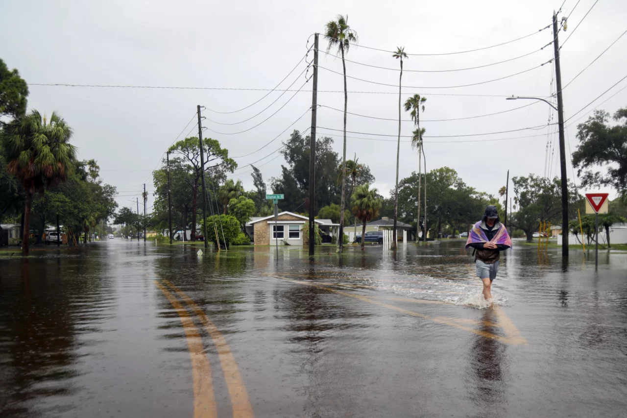
Floods have caused about $108 billion of damage in the U.S. since 2000, according to FEMA. Standard home and commercial property insurance does not cover flood damage.
But FEMA’s National Flood Insurance Program is available in 22,692 communities that have adopted and enforced floodplain management regulations. As of the end of July, it provided $1.3 trillion of flood insurance coverage to about 4.7 million policyholders — down about 1 million policies since the program’s peak participation in 2009.
Premium discounts ranging from 5% to 45% are available in jurisdictions that participate in FEMA’s Community Rating System, a voluntary program begun in 1990 that grades flood mitigation and safety measures on a 1-to-10 scale. A Class 1 rating earns the largest discount.

Most communities don’t seek the extra savings. Just 1,500 local governments take part in the Community Rating System, though they account for three-quarters of policies issued under the National Flood Insurance Program. Just two communities — Roseville, California, and Tulsa, Oklahoma — have achieved the top discount for their residents.
FEMA says it is important for communities to have access to dam-failure inundation maps in order to warn residents in harm’s way, That’s because dam failures can spread floodwaters beyond normal high-risk areas and affect multiple communities downstream.
But after the Sept. 11, 2001, terror attacks, some federal agencies cited national security grounds while refusing to release certain information about dams. They said dams could become targets if terrorists knew the potential to cause devastating flooding.
The Federal Energy Regulatory Commission continues to categorize dam inundation maps as critical infrastructure information that “could be useful to a person planning an attack” and requires those receiving such information to sign non-disclosure agreements, said FERC spokesperson Celeste Miller. But FERC can’t prevent a dam owner from independently sharing the information.
The Bureau of Reclamation also has required non-disclosure agreements when sharing dam inundation maps and emergency action plans with local officials. Under its upcoming policy change, the bureau will allow communities to publicly share information about dam inundation zones, including potential flood-wave travel times, flood depths and durations, said Sandy Day, the bureau’s chief of public affairs.
The Army Corps of Engineers, which also had shielded certain information about its dams, began posting dam inundation maps online in late 2021 after determining that releasing the information “is more beneficial to the public than any risk of misuse,” Corps spokesperson Gene Pawlik said.
Three years ago, FEMA sought public input about ways to revamp the Community Rating System to better incentivize communities to reduce flood risks. Several commenters highlighted difficulties in getting credit for dam initiatives, including the reluctance of federal agencies to share information regarding inundation zones from dam failures.
Nothing immediate came from the 2021 review. Though FEMA is again seeking public input on potential changes to the Community Rating System, it doesn’t plan to make any changes until 2026.
The U.S. Government Accountability Office has suggested a substantial overhaul may be necessary. In a report last year, the GAO found that the premium discounts offered under FEMA’s rating system are not actuarially justified. Mapping projects, flood warning procedures and public information campaigns may have some value, the report said, but don’t reduce the flood risk of currently insured properties.
Some local officials contend FEMA’s Community Rating System is too costly and complex, especially for governments with small budgets and staffs. The rating system has about 100 items for which communities can earn points, often requiring extensive documentation. The dam safety section is among the most challenging — just four communities got any points for their local efforts during the most recent evaluation, according to FEMA data.
__
Republished with permission of the Associated Press.
One comment
Delusions
August 25, 2024 at 5:41 pm
Floods and quake’s and sulphur it will be a doozy.. mother nature’s rage upon you
Comments are closed.