

As engineers seek new ways to map Florida, lawmakers look ready to fund the giant lasers to help.
House budget leaders agreed in a Monday conference meeting to put $15 million toward (Light Detection and Ranging (LiDAR) mapping.
The sizable budget item appeared in a Senate Transportation, Tourism, and Economic Development Appropriations budget offer earlier in the day, but had never surfaced in budget proposals before that point.
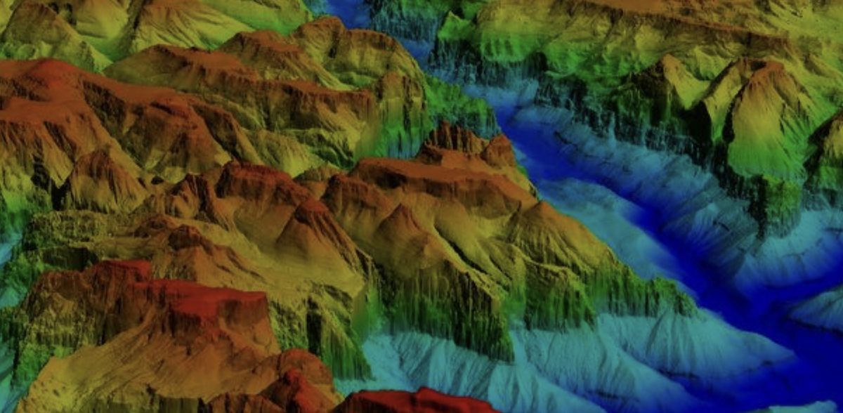
According to the U.S. Geological Survey, LiDAR mapping employs laser scanners, GPS technology, and an Inertial Navigation System, typically mounted to small airplanes that survey territory. Using brief pulses of light directed to the ground surface, the system measures the distance from the ground to the earth to create a three-dimensional map of the terrain.
The LiDAR mapping funding is included in the Department of Transportation’s budget. Notably, the $15 million budget item corresponds precisely to the savings from eliminating 146 positions in the state agency, a reduction agreed upon by the House at the same time it accepted the high-tech spending.

LiDAR technology isn’t anything new to the state government. The Florida Geographic Information Office has maintained 3D information gathered using the precise sensors since 2022. That’s when two USGS Quality Level 1+ LiDAR collection contracts managed by the Division of Emergency Management were completed.
One of those gathered information on the terrain in 58 Florida counties in creating a geospatial model. The second contract was used to obtain further details on the Panhandle counties impacted by Hurricane Michael in 2018.
All of the gathered information is publicly available to download. It has also been shared with both the USGS and the National Oceanic and Atmospheric Administration for use by the federal government.
The level of detail available from modeling produced using LiDAR technology offers a greater level of detail than is available using photography and provides more information in mapping than is typically available in GPS data.
2 comments
7Clean
June 9, 2025 at 9:32 pm
Grouse post! Made my day so much better.
AJ
June 9, 2025 at 10:02 pm
We hope they map termite swarming also..
Comments are closed.