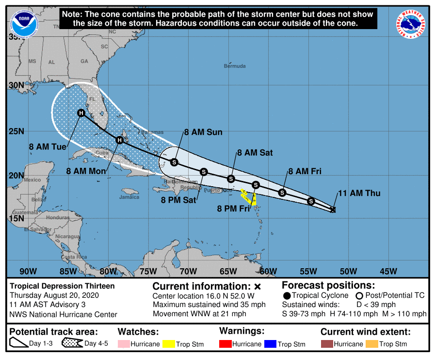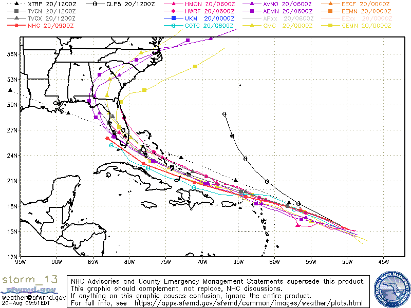
Tropical Depression 13 is barreling toward Florida and threatening to strengthen into Tropical Storm Laura late Thursday, according to the National Hurricane Center.
Current projections from the South Florida Water Management District forecast the weather system to impact Florida early week. The National Weather Service, however, described an impact to South Florida as all but certain.
“South Florida is still in the forecast cone of Depression 13, but there is still high uncertainty to determine what, if any, impacts this system may have on South Florida at this time,” NWS Miami tweeted.

As of 11 a.m., Tropical Depression 13 was located roughly 750 miles east-southeast of the northern Leeward Islands and traveling west-northwest toward Florida at 21 mph.
The NHC said the system is producing heavy rain and maximum sustained winds of 35 mph with higher gusts. Rain totals are estimated at 1 to 3 inches over the Northern Leeward Islands with certain areas experiencing a maximum of five inches. Puerto Rico and the Virgin Islands, meanwhile, are forecasted to receive three to six inches of rain through Sunday.
Tropical storm watches are in effect for St. Maarten, Saba, St. Eustatius, Antigua, Barbuda, St. Kitt, Nevis and Anguilla. Additionally, the NHC advised portions of Hispaniola, Cuba, the Bahamas and Florida to monitor the system’s progress.
A tropical storm watch means tropical storm conditions are possible within 48 hours.
Gov. Ron DeSantis on Thursday said the state is monitoring the weather system and encouraged Floridians to ready seven days worth of supplies.
In August, The National Oceanic and Atmospheric Administration upgraded the 2020 Atlantic hurricane season outlook from “above-normal” to “extremely active.”
The updated outlook forecasts 19 to 25 named storms this season, seven to 11 of which would likely become hurricanes. The outlooks also calls for three to six of those storms to develop into major hurricanes before November.


